


Roads
The IRCA is responsible for, and oversees all new transportation projects in development, as well as handling all development, maintenance and service of the road system.
The country’s road system is split into highways, municipal roads, general trails, and private roads. Using this system, highways and municipal roads form a natural, contiguous road system, connecting the developed areas of the island.
Road variations
Highways
Highways are roads for the public maintained and serviced by the state. Roads are listed in the roads list. The IRCA is the party responsible for highways, municipalities are the party responsible for municipal roads and the owners of private roads are responsible for the upkeep of the roads which they own.
Other roads
Municipal roads are roads within a developed area that are not classified as highways, cf. Article 8. They are managed by municipalities and are meant for unrestricted public traffic.
Road classification
A | Roads consisting of two separated roadways, at minimum four total lanes, shoulders and/or curb stones |
B | Roads consisting of two-to-four separated lanes and a central reserve of 2m at minimum,12m ≤ total width ≤19m |
C | Roads consisting of two lanes, 7m ≤ total width ≤10 m |
D | Roads consisting of one lane and laybys |
F | Trails |
A34 | Roads consisting of two separated roadways, with at least four lanes, shoulders, and/or curb stones with a width of ≥34 m, not including curb stones. Daily traffic volume (ÁDU) ≤55,000 (urban area) |
A22 | Roads consisting of two seperated roadways, with at least four lanes, shoulders and/or curb stones, with a width between 22-24 m, not including curb stones. ÁDU ≤50,000 (grade-separation, urban area) |
B19 | Roads consisting of two separated roadways, with three lanes, shoulders and/or curb stones with a width between 19-20 m, not including curb stones. ÁDU ≤45,000 (grade-separation, urban area) |
B15.5 | Roads consisting of two separated roadways, with three lanes, shoulders and/or curb stones, with a width of 15.5 m. ÁDU ≤15,000 (grade-separation) |
B12 | Roads consisting of two separated roadways, with two lanes, shoulders and/or curb stones, with a width of 12 m. ÁDU ≤6,000 (flat land) |
C10 | Roads consisting of one roadway, with two lanes, shoulders and/or curb stones, with a width of 10 m. ÁDU ≤7,000 (rural area, flat land) |
C9 | Roads consisting of one roadway, with two lanes and shoulders, with a width of 9 m. ÁDU ≤4,000 (rural area, flat land) |
C8 | Roads consisting of one roadway, with two lanes and shoulders, with a width of 8 m. ÁDU ≤3,000 (rural area, flat land) |
C7 | Roads consisting of one roadway, with two lanes and shoulders, with a width of 7 m. ÁDU ≤500 |
D4 | Roads consisting of one roadway (with laybys) with a width of 4 m. ÁDU ≤50 |
F1 | Trails — traversible for general traffic in the summertime. Nothing more than a trail, at a lower elevation than the surrounding area, more often than not. Width around 4 m. Large lakes and rivers bridged. These roads are often closed over the winter due to snowfall, and due to mud-wet conditions during the thawing period. |
F2 | Trails — traversible with four-wheel-driven vehicles, powerful passenger vehicles and jeeps. Nothing more than a trail, at a lower elevation than the surrounding area, more often than not. Width around 4 m. Lakes and small rivers unbridged. Often closed over the winter due to snowfall, and due to mud-wet conditions during the thawing period. |
F3 | Trails — only traversible with large, well-equipped, four-wheel-drive vehicles or superjeeps. Nothing more than a trail, at a lower elevation than the surrounding area, more often than not. Potentially uneven, rocky,and littered with puddle build-up. Width around 4 m. Often closed over the winter due to snowfall, and due to mud-wet conditions during the thawing period. |
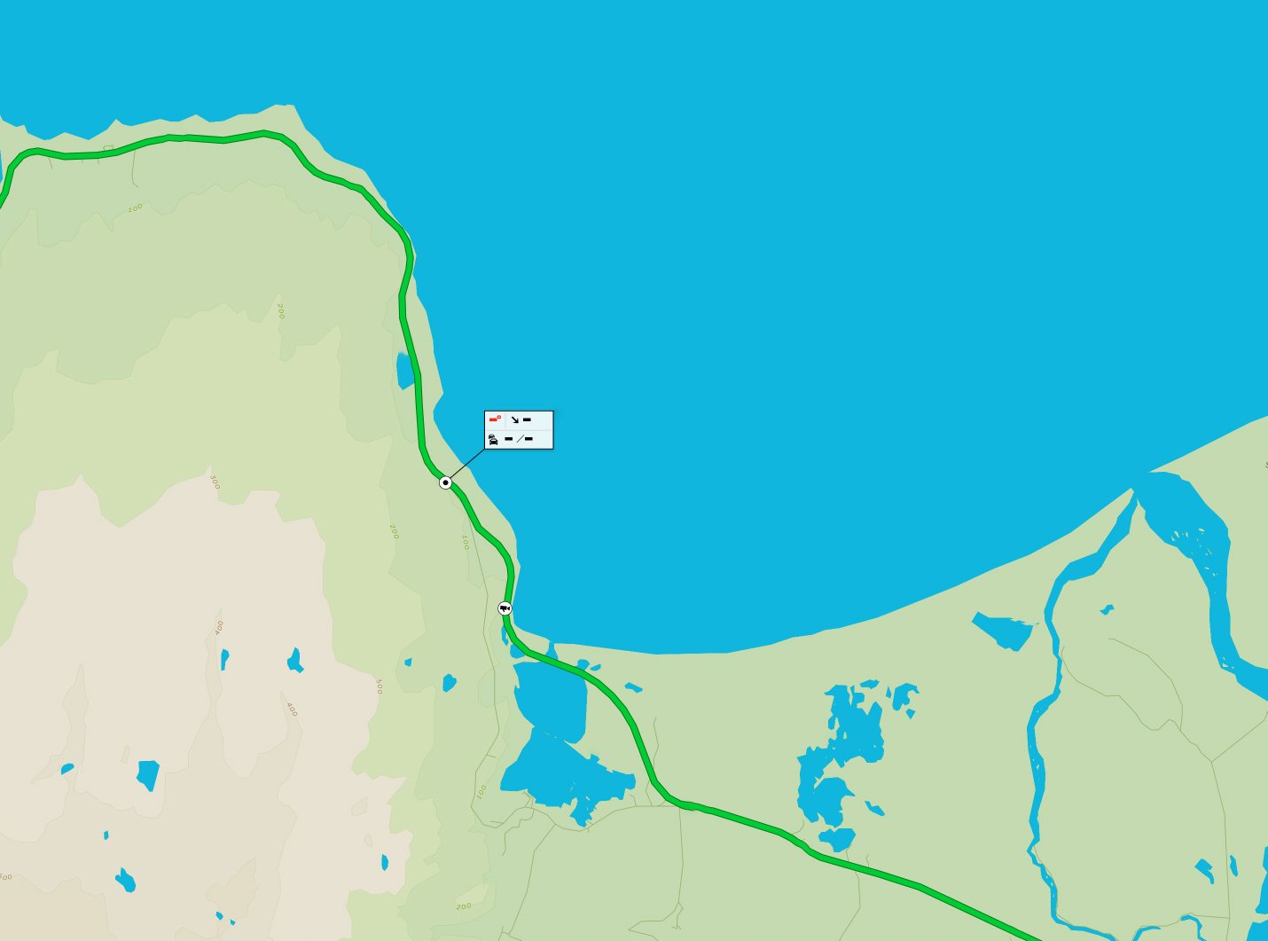
Mountain roads
The opening of mountain roads depends on weather during the spring and at the beginning of summer.
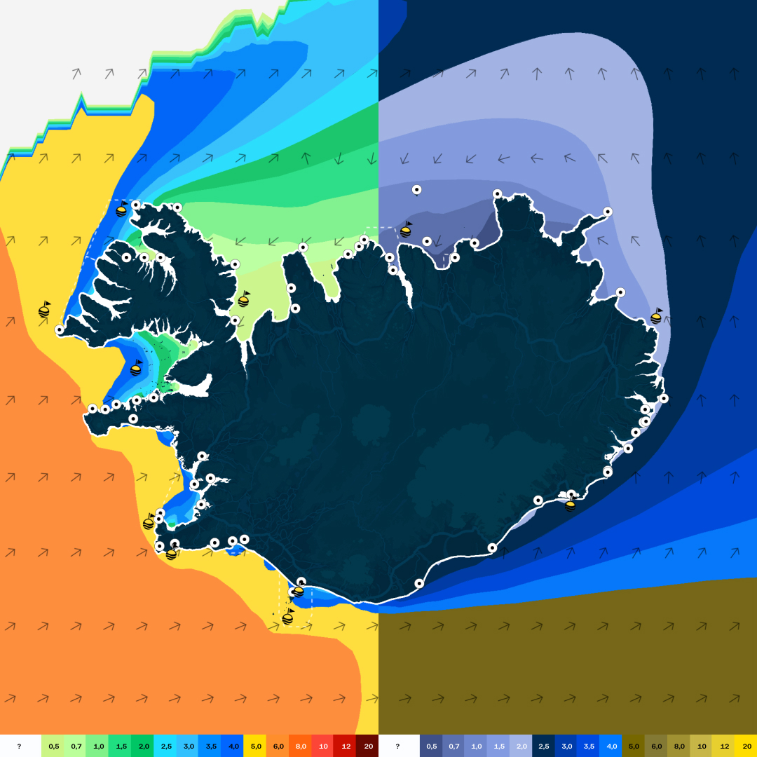
The IRCA publishes a map in the spring and into the summer that shows where mountain roads are open. The map is updated as conditions change.
Information about traffic and road conditions is published on umferdin.is
Highland map (PDF file)
Here you can also find information on the opening of mountain roads which shows the estimated opening dates of the main mountain roads.
Grants for transport links
You can apply for funding to strengthen certain transport routes that do not fall under the definition of roads according to the Road Act. Subsidized transport routes must be open to all public traffic. Apply on My Pages – Applications are open in February.
Traffic lights
Of the municipalities which constitute the capital region, Reykjavík has the most traffic lights. A portion of these traffic lights are situated along roads under IRCA ownership. Following the Transportation Agreement the IRCA and the six capital region municipalities entered into a collaborative agreement, wherein traffic light responsibility is shared.


