


Reykjanes peninsula – Volcanic activity
Since March of 2021, volcanic activity on the Reykjanes peninsula has steadily ramped up, with regular eruptions threatening private property in Grindavík, energy infrastructure in Svartsengi, and the Blue Lagoon. The IRCA keeps a close watch on developments in the region in order to ensure that the transportation system can service the fluctuating needs of the Reykjanes population.
Reykjanes peninsula – Volcanic activity

Volcanic history of Reykjanes
Historical records of volcanic activity on the Reykjanes peninsula date back more than one thousand years. Five distinct volcanic systems are located within the peninsula: the Reykjanes system, Svartsengi, Fagradalsfjall, the Krýsuvík system, and the Brennisteinsfjöll/Bláfjöll system. This volcanic ecosystem typically lays dormant for around 800-1000 years before activating, and its volcanic periods are known to last for centuries at a time. The last recorded volcanic period on the peninsula began around 950, and lasted until roughly 1240.
After centuries of hiatus, the Icelandic Meteorological Office reported in 2019 that seismic activity in the region indicated a new volcanic period was on its way. The first eruption began thereafter in March of 2021, with the formation of lava fissures in Fagradalsfjall. Eruptions in the Fagradalsfjall volcanic system concluded in 2023, but recent eruptions have centered around Svartsengi, threatening infrastructure and upending lives for the residents of Grindavík.
Responding to the new eruptions
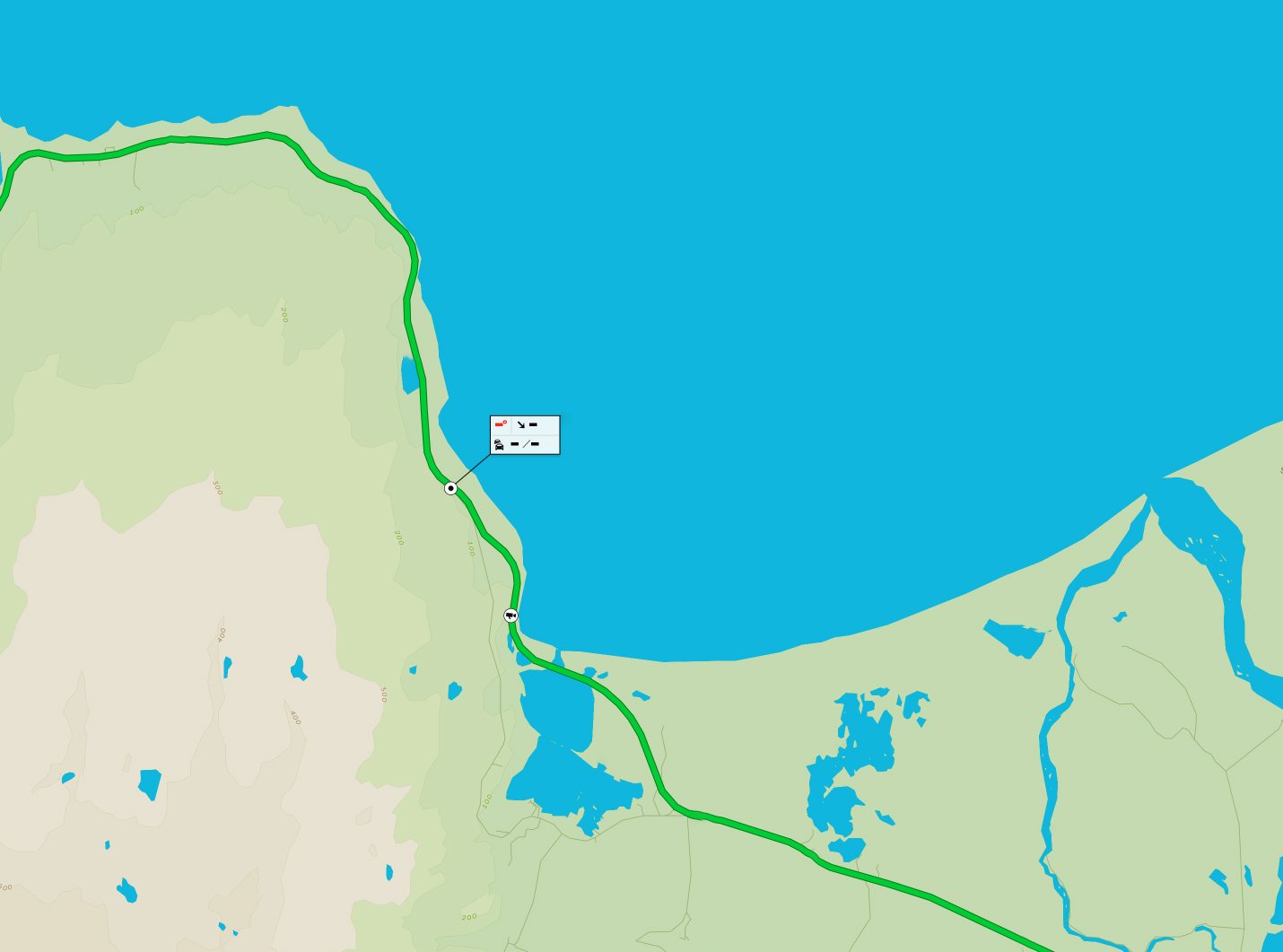
The IRCA has undertaken considerable work in making sure that main evacuation routes around Grindavík, the Blue Lagoon and the Svartsengi plant remain open in case of further volcanic activity.
Emergency road repair, construction, and their subsequent protection through the construction of lava embankments are just some of the projects which have been high on the list of IRCA priorities on the Reykjanes peninsula over this new volcanic period. The IRCA has also committed to increased winter service in the region, and assisted in mapping out cracks and cavities under Grindavík and its surrounding area.

Lava embankment near Grindavík.

The old road to Grindavík (43) under fresh lava.
Disruptive effects
Outside of considerable infrastructure damage and frequent evacuation orders being issued to Grindavík, the Blue Lagoon and the Svartsengi power plant, these eruptions have often lead to a severe decrease in air quality around the country as sulfur dioxide (SO2) is dispersed, combining with oxygen and condensation in the atmosphere to create sulfate (SO4) or “gosmengun” (eruption pollution) that lingers over urban areas in mild conditions.
In such conditions, it is not recommended that anyone exerts themselves, or undertakes any strenuous tasks outside. Travellers with documented breathing problems or other health ailments are strongly encouraged to assess the situation before making any journeys to, from or around the eruption zone where sulfate pollution could be present, and all travellers are encouraged to check loftgæði.is for information regarding ambient air quality around the country.
Travelling to eruption zones
As long as eruptions continue, demand for sightseeing in the area will continue alongside them. The IRCA, in co-operation with ICE-SAR, seeks to ensure that travellers do not suffer accidents when hiking to the eruption sites.
As with all IRCA operations, safety remains a top priority. Travellers are asked to respect the guidelines and warnings issued by professionals in the area, and to stay on marked tracks, as unmapped cracks in the earth and other fissures can be extremely dangerous to anyone that strays away from the beaten path.
Under no circumstances should anyone seek to stand on newly hardened lava fields. Considerable warmth might still be lingering under the fields’ weak surface, which could crack or break at any moment, and there could potentially be only a few centimetres between hardened rock and flowing lava underneath it.