5 júní 2025What factors affect the tides in Iceland?
What factors affect the tides in Iceland?
Sigurður Sigurðarson, a coastal engineer at the Port Department of the Icelandic Road and Coastal Administration, answers the question: What factors influence tidal waves in Iceland? The answer can be found on visindavefur.is and is published with the kind permission of the website Vísindavefur.
From the sea, there are several factors that have an influence. The most important ones are sea level and wave height. Sea level is then determined by several factors, on the one hand, astronomical tides and on the other hand, so-called contributors of three types caused by low air pressure, regional winds, and rising sea levels within the breakwater.

Sigurður Sigurðarson coastal engineer
In the southwest and west of the country, the tides are the most influential factor. The mean high tide during a moderate tide in Reykjavík is at +4.0 m, while the low tide is at +0.2 m. During a small tide, the mean high tide is at +3.0 m and the low tide is at +1.3 m. These figures are for moderate and small tides, but the currents vary in size. Thus, the high tide during the spring tide in early March 2025 reached a peak of +4.4 m.
Atmospheric pressure affects sea level; high atmospheric pressure pushes the sea level down, while low atmospheric pressure causes it to rise, which is called pressure effect. In the deepest depressions, the pressure effect can reach up to about 0.8 m here near the land. Under certain conditions, a land breeze can create a wind effect. For this to happen to a certain extent, the depth must be small over a relatively large body of water. Waves in most places will not be more than about 0.3 m here along the coast, mainly because in most areas it is deep. The wind is not lacking. While wave setup due to low pressure and wind is little changed over somewhat large areas, wave setup is very localized. Wave setup occurs within the surf zone where elevated sea levels due to wave breaking do not have direct access to the open sea. Wave setup increases with both rising wave height and wave period. In most places, wave setup will not exceed about 0.5 m but can be greater under certain conditions. However, inside harbours where there is good shelter from the waves, like in Reykjavík harbour, there is no wave setup.
Floods occur when high tide reaches the shore and the sea overtops a natural beach ridge or coastal defense structure. There are shallow areas offshore in many places, and then the wave that causes the flood is depth-dependent; the higher the water level, the higher the wave reaches the shore and the greater the flooding.
Tides are, in fact, an interplay of weather factors and sea currents that depend on the position of the moon and the sun. The weather factors, atmospheric pressure, wind, wave height, and wave period are interdependent. As atmospheric pressure decreases, wind speed increases, leading to higher wave heights, and as the weather persists for longer, the wave period lengthens. Tides, however, are an independent factor.
If we imagine a very deep low pressure system approaching the land from the southwest, that low can occur on a small tide or at low sea level and not cause any coastal flooding. However, a much shallower low arriving on a high spring tide and hitting at high tide can cause significant coastal flooding.

Sea and rocks flooded over Fiskislóð in the big storm on March 31st.

Considerable damage was suffered by the storm.
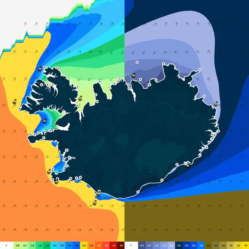
The Icelandic Road and Coastal Administration (IRCA) has examined the tidal flood that occurred in Reykjanes and the inner Faxaflói from March 1 to 3, 2025. The height of the significant wave outside Faxaflói was over 10 m for nearly 24 hours, starting from noon on March 2, reaching a maximum of 16.0 m. If wave direction is not taken into account, a 16 m significant wave has a return period of about 20 years, while a higher return period is considered when taking wave direction into account. In Reykjavík and Akranes, the water level was measured at about +4.6 m, which is about 0.2 m lower than the water level with a 1-year return period. In Sandgerði, the water level was measured at a maximum of +4.5 m, corresponding to about a 10-year return period.
At the time this text is written, IRCA has not assessed the return period of the flood event but will do so shortly.
The extent of coastal flooding from the land depends primarily on the height of natural coastal barriers or coastal defense structures. Natural coastal barriers often build up to the height that they overflow several times a year. Coastal defense structures are built to prevent coastal erosion on one hand, and to limit inundation over them on the other. Secondly, the extent of coastal flooding is influenced by the elevation of the land within the coastal barriers or structures. If the land is low and there is no easy way for the sea to flow back out, it will accumulate, and the flood height on land will be higher than the sea level. For property damage, it matters whether land in low-lying coastal areas slopes towards or away from buildings.
Due to the danger posed by tidal floods, IRCA is a consulting body for the master plan and zoning plan in low-lying areas near the sea. When providing opinions, the Road Administration’s guidelines on minimum land and floor heights are taken into account, which are based on tectonic movements and sea level rises determined at any given time according to the latest information. Consideration is given to the report from the scientific committee on the effects of climate change in Iceland and land elevation changes measured with GPS stations and satellites. For general planning, the reference guidelines are based on a 100-year lifespan of buildings and planning. Furthermore, the estimated change in the position of land and sea over the next 100 years is taken into consideration.
With rising sea levels due to global warming, the risk of sea floods increases. Not only does the freeboard of seawall and coastal defenses decrease when sea levels rise, but higher waves also reach shallows in front of seawalls and coastal defenses where the wave height is depth-dependent. Both of these increase susceptibility and flood risk.


